PEOPLE-ECCO Solutions
Six Solutions have been developed and applied in varying ecosystem regions within the PEOPLE-ECCO project:
- Vegetation Disturbance Occurrence: Detects abrupt vegetation disturbance (e.g. clearing, fire) by fitting piecewise-linear segments to multi-year spectral-index (NBR/SAVI) time series and flagging segments with strong negative change, in the spirit of LandTrendr-style trajectory segmentation.
- Submerged Aquatic Vegetation and Coral Reef Habitat Extent: Maps the spatial extent of seagrass meadows and coral reef habitat from multispectral satellite imagery using water-column correction and classification adapted for shallow, optically complex coastal waters.
- Vegetation Productivity Trend: Quantifies long-term vegetation recovery/productivity at restoration and protected sites by fitting (seasonal) Sen's-slope trend lines to spectral-index time series against a historical or reference recovery target (R80P, DeltaIR metrics).
- Habitat Disturbance Rating: Combines vegetation-disturbance breaks, fire occurrence, and built-area pressure into a single normalized, user-weighted composite score per management zone to support conservation prioritization.
- Aquatic Habitat Frequency and Connectivity: Assesses the temporal persistence (detection frequency across a time series) and spatial connectivity (patch/network metrics) of aquatic habitats such as seagrass or coral to characterize their stability and fragmentation.
- Before-after-control-impact: Statistically matches impact and control units and applies a before/after difference-in-differences contrast to isolate the true ecological effect of a conservation action from the counterfactual scenario.
Details on these and how to apply them for a conservation site are provided in the Solutions Handbook.
PEOPLE-ECCO Platform
The PEOPLE-ECCO Platform is a user-centred application that allows users to execute PEOPLE-ECCO Solutions via the web browser. It features as user authentication layer (based on Keycloak) and a set of different components, described below.
Architecture:
- Web UI – a map-centered web portal (built on Open Pioneer Trails) for visualizing study sites, time series, processing jobs, and spatial results.
- Backend API – Python-based, it provides an API that manages scenarios, processes, timeseries, job orchestration, coordinated via Prefect. It also realizes openEO integration (authentication, job management) for Solutions and algorithms.
- Solutions – six thematic algorithms covering aquatic ecosystems (vegetation mapping, habitat connectivity), terrestrial monitoring (productivity trends, disturbance detection), and impact assessment (before-after-control methods).
- Algorithm Framework – a standardized execution contract that allows the platform to create reproducible analysis results.
The overall design focuses on modularity and extensibilit (i.e., algorithms) as well as open standards to ensure longevity of Solutions and algorithms.
Web UI
The Web UI features three main views, which are described below.
Landing page
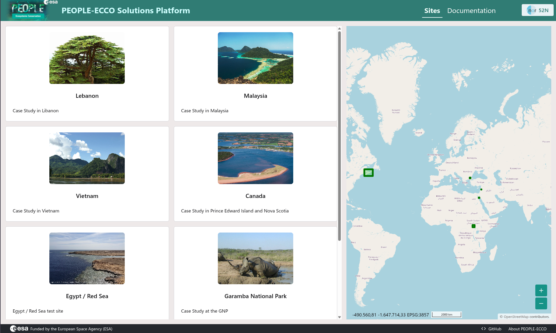
The landing page presents the available test sites as a card list alongside a world map marking each site's location. Users can select a site to enter its dedicated view (see below).
Site analysis results
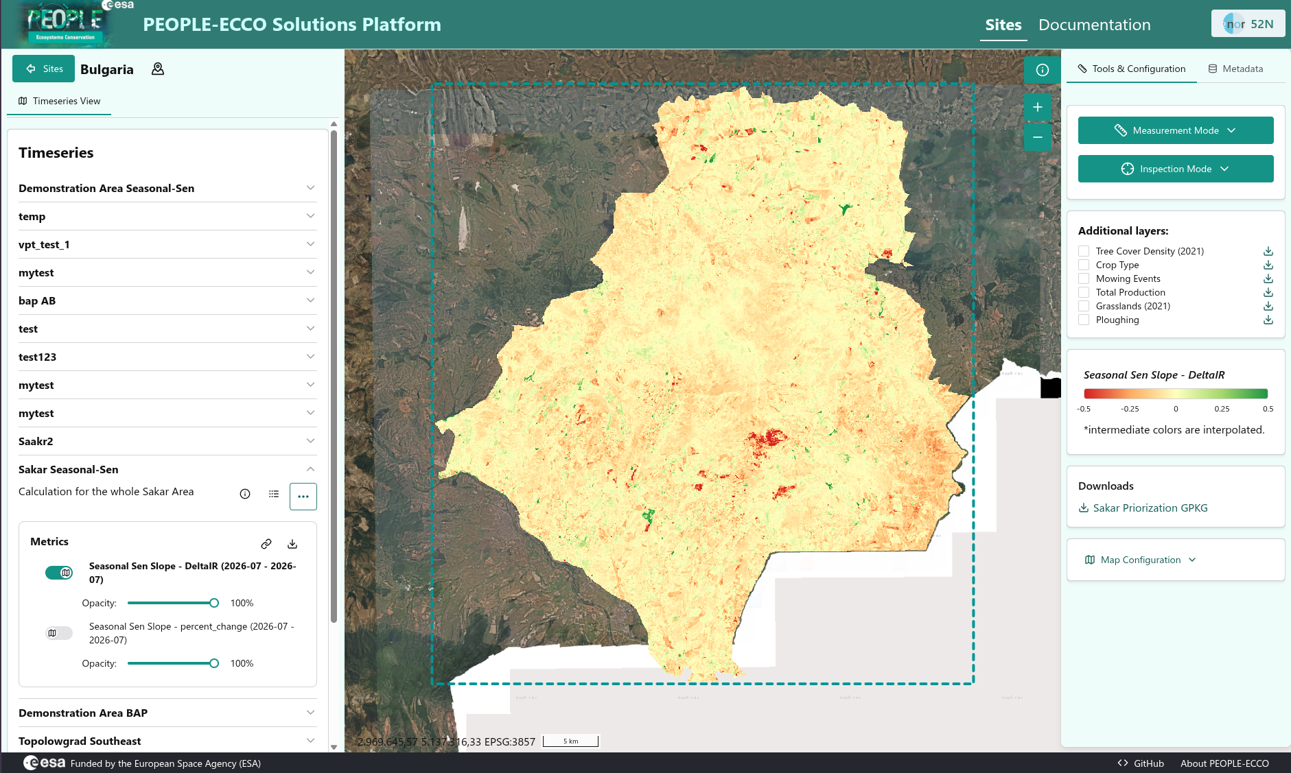
This view shows the result of Solution execution for a particular site. Here the results for the Seasonal Sen's Slope algorithm, applied to the Sakar region in Bulgaria, are shown. The map overlays a color-coded trend layer (red to green, indicating negative to positive slope in DeltaIR) on satellite imagery of the area, with additional layers (e.g. Tree Cover Density, Crop Type, Grasslands). The table of contents on the left side allows users to select different time series and inspect their results.
The site view also allows users to download all result data for a particular timeseries (as a Zip archive) and create temporary pre-signed links to individual results (e.g. COG or GeoJSON) for direct integration into related applications (e.g. the BACI solution).
Creation of a new timeseries
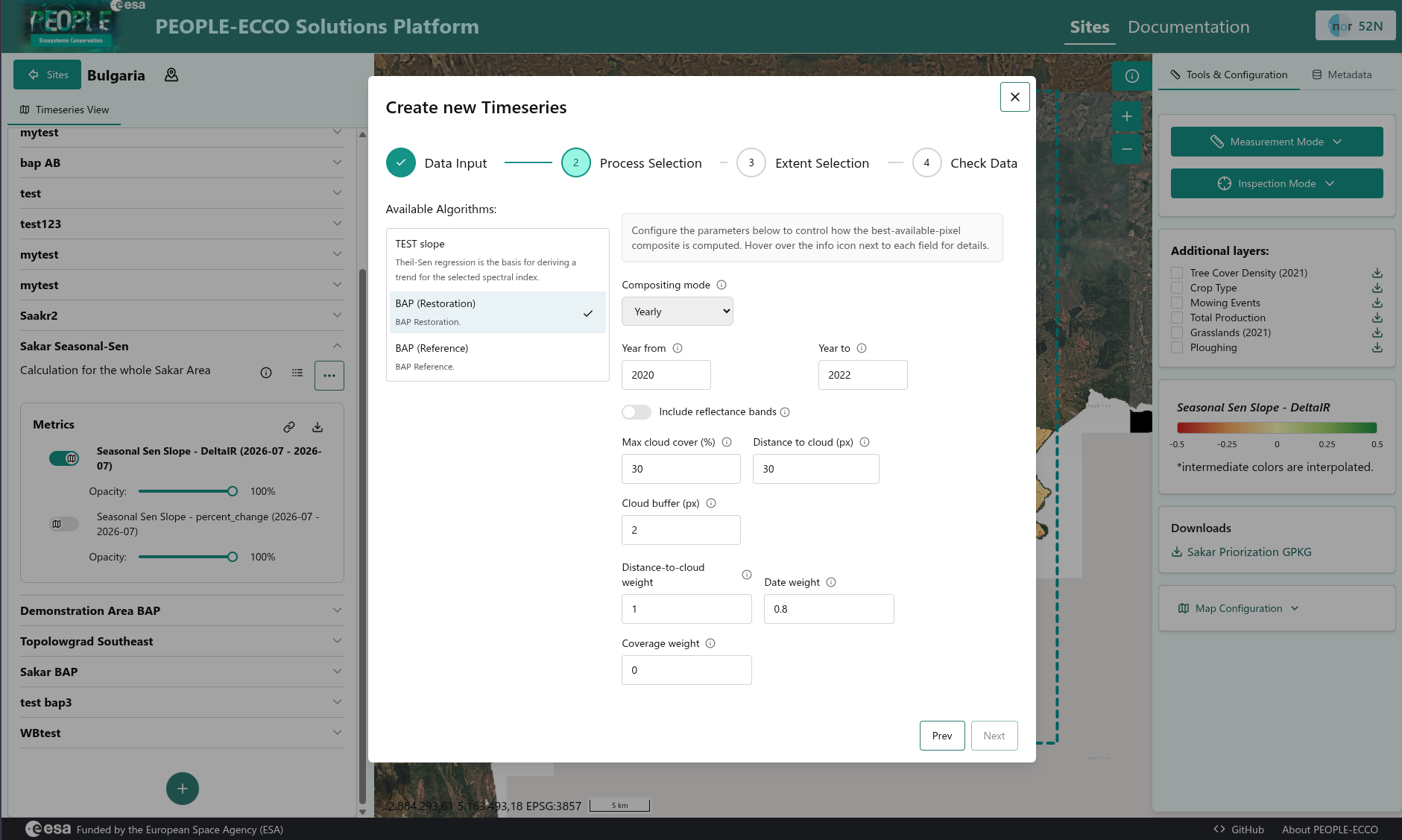
Via a dialog users can create a new timeseries in the (spatial) context of a site. Each timeseries references a specific PEOPLE-ECCO Solution/algorithm (here, "Best Available Pixel for Restoration Sites") and is configured through a step-by-step wizard: users set parameters which are specific to the particular PEOPLE-ECCO Solution.